Pink Lakes Las Coloradas

The amazing Pink Lakes Las Coloradas.

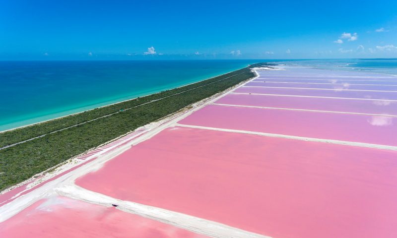
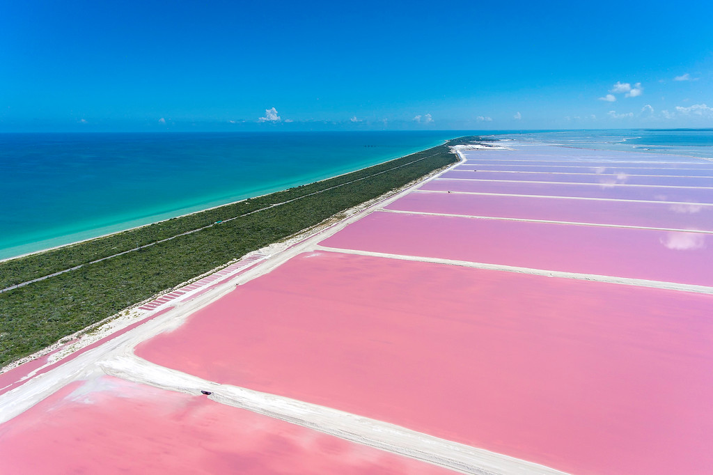
Las coloradas means “the red” and is the name of a tiny Mexican fishing village with a small population. Nearby, a series of brightly colored pink lakes cover the landscape on the edge of the Gulf of Mexico.

Pink Lakes Las  Coloradas

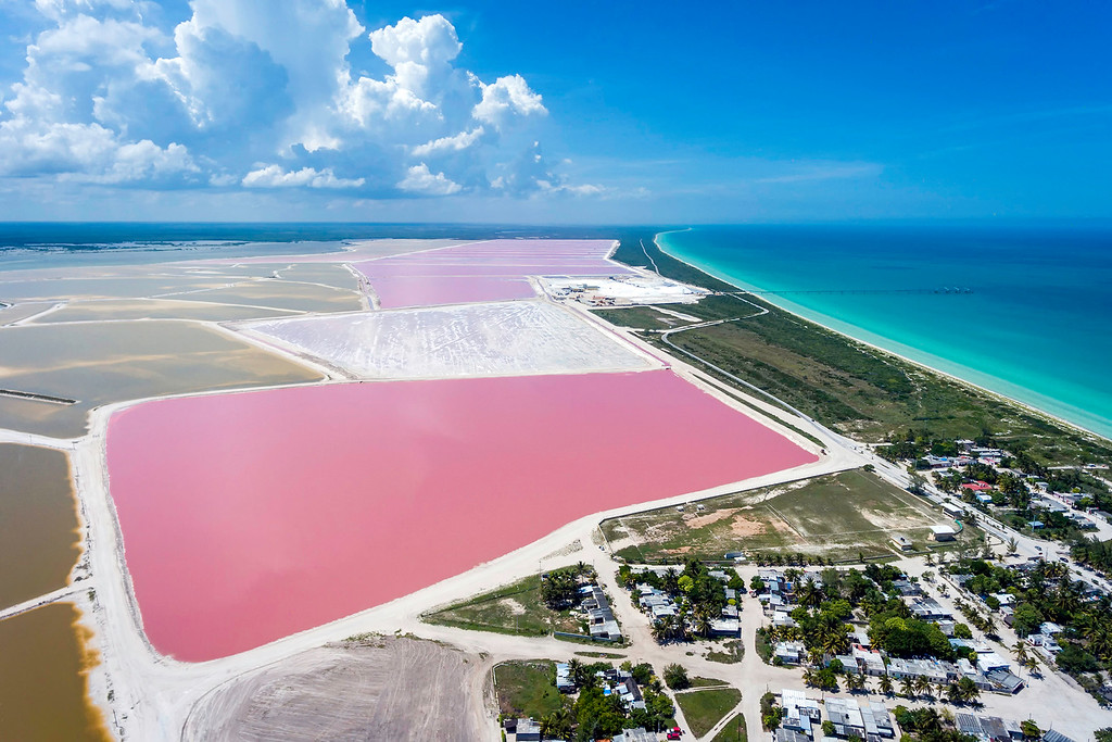
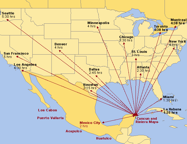
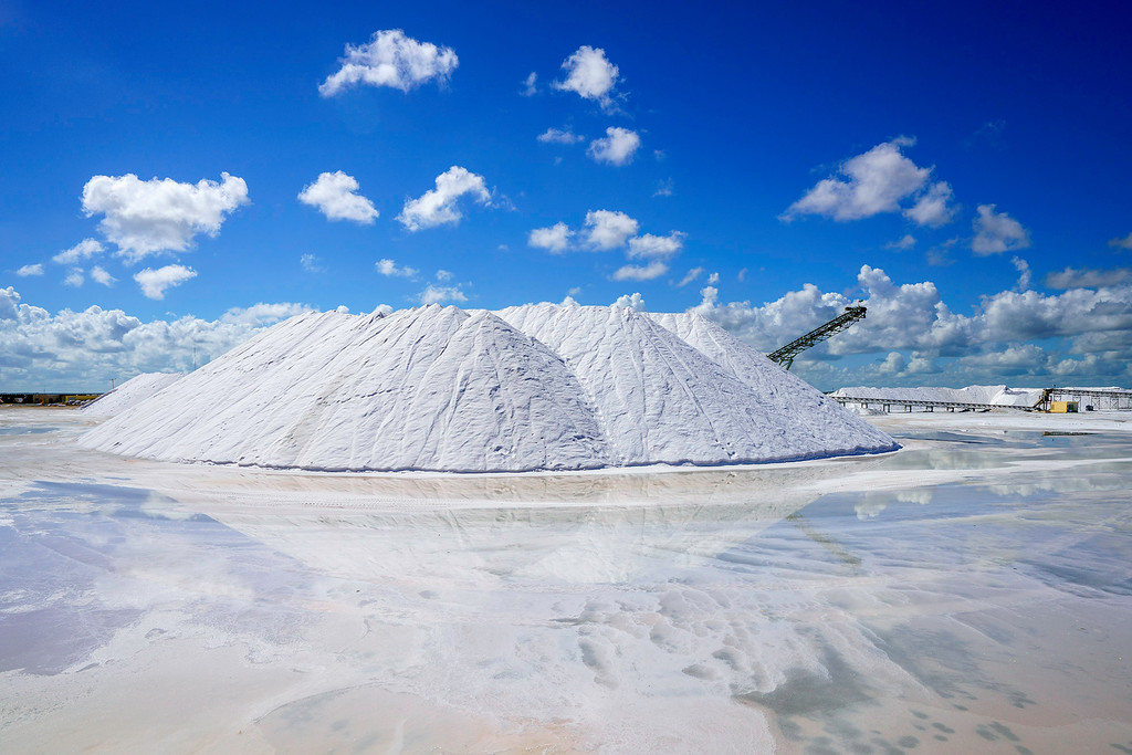
Las Coloradas is located 128km (79miles) away from Cancun and 144km (89miles) from Playa del Carmen. The pink color of these lakes is due to red-colored algae, plankton and brine shrimp that thrive in the salty environment. As the water evaporates these organisms become more concentrated, glimmering pink in the bright sunlight.

Pink Lakes Las Coloradas

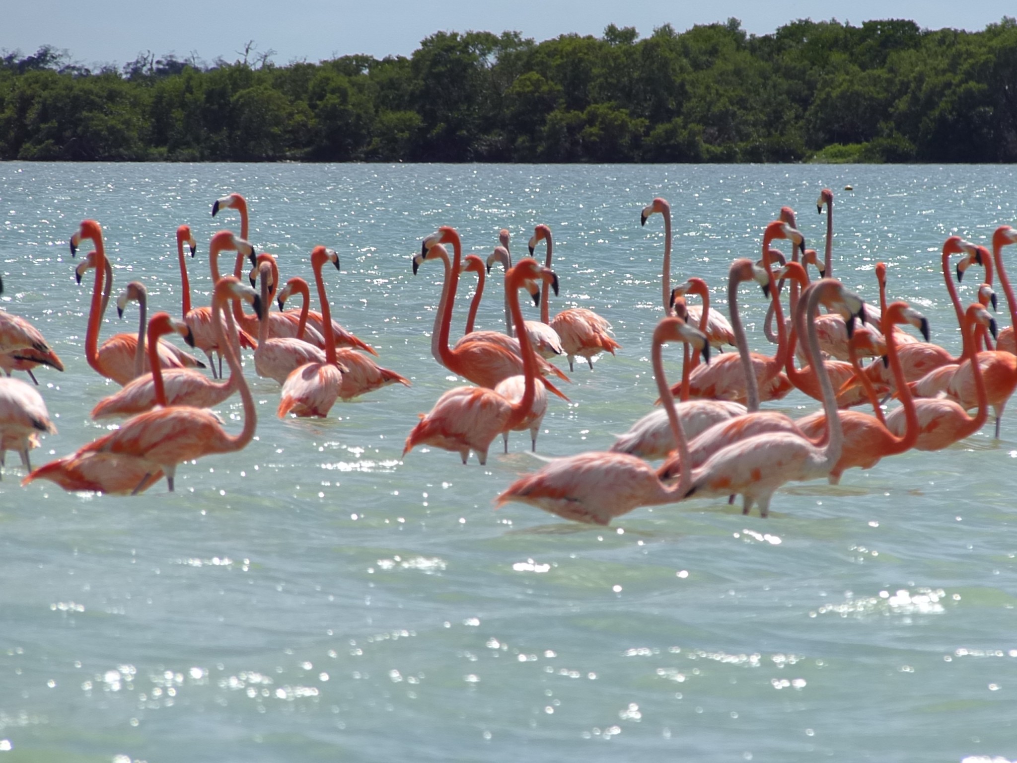
At Las Coloradas you can find Pink Flamingos, who usually visit the area in some seasons offering a great show. The pink water is incredibly salty, so while safe to get in. However it is more to take pictures than anything else, because the lakes are only about a foot deep.

Pink Lakes Las Coloradas

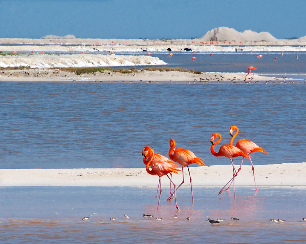
By tradition, Las Coloradas has a great salt production. Salt was very important for the nutritional needs of the Mayans as well as food preservations. It was mined here and and then shipped by canoe to other parts of the Mayan empire. Currently a company produces salt on a much larger scale (550,000 tons per year).

Pink Lakes Las Coloradas

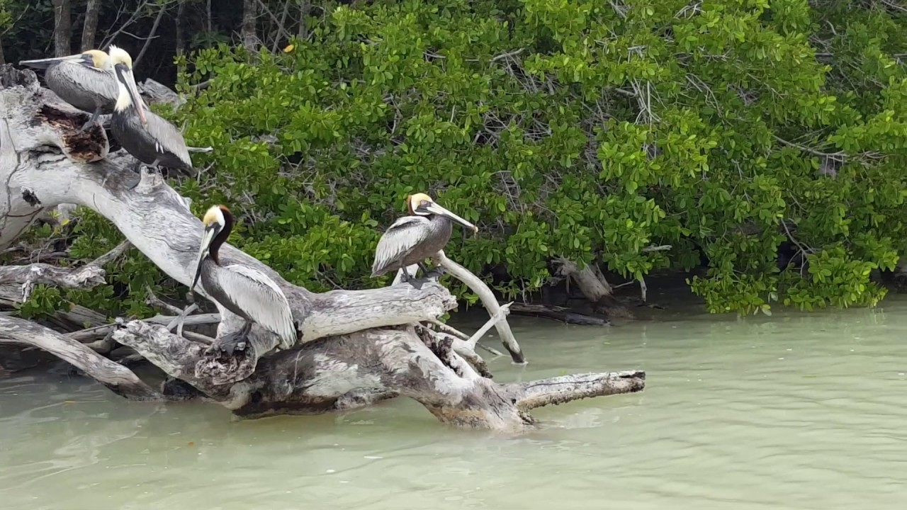
Very close (30 minutes away) from the pink waters of Las Coloradas is located Rio Lagartos, which is a Biosphere Reserve, home to animals like flamingos, crocodiles, sea turtles, jaguars, and all kind of sea birds.

Pink Lakes Las Coloradas

Pink Lakes Las Coloradas

To get to Las Coloradas you can do it by renting a car or hire a private van transportation with a bilingual driver who knows the area and can suggest places to eat or shopping. What we do not recommend is to go on your own on local buses, because they take a lot of travel time. In case you want to hire a private van please contact Canada Transfers to send you a quote. https://www.canadatransfers.com/contact/

10,325 total views, no views today

Geography of Cancun & Riviera Maya

It is located at a distance of 370 km from the capital of the state of Quintana Roo, (Chetumal), 70 km from Playa del Carmen, on the eastern side bordering the Caribbean Sea, in the west with the municipality of Lázaro Cárdenas, towards The north with the municipality of Isla Mujeres and the south with the municipality of solidarity. The total size of the territory is 1664 km and 22 km of coast, is northeast of the Yucatan peninsula and only 7 km from Isla Mujeres. Cancun is geographically divided into 5 zones:

Hotel Zone: This is considered the most important part given that it is the part that gives the sea and most of the tourist activities that is the main economic source of this destination. It houses most of the hotels, residential areas and beaches, the Pok Ta Pok golf course and the entrance to Cancun port, this island is linked to the mainland by three bridges; The Calinda bridge at km 4, then the Club Med bridge at km 20 and finally the Nizuk bridge at km 22. In the center of this island is the Nichupté lagoon, which is composed of 7 bodies of water: Laguna Bojórquez, Cuenca del Norte, Cuenca Central, Cuenca Sur, English River, Del Amor, and Lagunita del Mediterráneo.

Urban zone: this refers to the center of the city, where the majority of the population lives, which in turn works in the hotel zone, is not frequented by most of the tourist population although it has many attractions including monuments and Museums, in this area is located most of the governmental, educational and cultural institutions and are divided into super apples mainly.

Puerto Juárez: In this area there are two main docks that are used to embark to Isla Mujeres, which is dedicated mainly to fishing. It consists of three supermanzanas, the 86 that reaches the ruins of El Meco and 84 and 85 which are mostly dwellings. It has several palapas, several of them abandoned, although it is a great option to eat in one of its many restaurants of fish and seafood, this thanks to that the majority of the inhabitants of this zone are fishermen.

Franja Ejidal: in this area are settlements that are distributed irregularly in the northern part of the city, on the border with the municipal boundaries of Isla Mujeres. Here live a part of the poorest population, many immigrants from other parts of the country.


Coastal Zone: This is a strip of white sand that runs all the eastern side of the municipality, most of it is the hotel zone, counting with 9 public beaches: Playa las Perlas, Playa Langosta, Playa Tortugas, Playa Caracol, Playa Chac mool, Beach Marlín, Playa Ballenas, Playa Delfines (the famous Mirador) and Nizuc Beach.

13,154 total views, no views today